
eNetra Forest Monitoring System
Satellite change detection for forest divisions, carried through to verified closure.
An AI-powered platform that leverages satellite data and machine learning to monitor and detect deforestation, land cover changes and illegal activity in forest areas — at scale, in near real-time. Detection is one stage of the process: every alert is routed to a named field officer, verified on site with geo-tagged evidence, and closed with an auditable record.
Capabilities
What Forest Monitoring does.
Multi-date change detection
Sentinel-2 imagery is compared across three dates on Google Earth Engine to separate genuine land-cover change from seasonality, cloud and shadow. Crop cycles, wasteland conversion and new construction are distinguished rather than lumped together.
Three datesAlerts resolved to an accountable officer
A detection is not an alert until it has a jurisdiction, a priority and an owner. Every polygon is resolved against the beat, range and division boundary it falls in and pushed to the officer responsible for that patch.
Named ownerGround truth from the field
Officers navigate to the alert coordinates, capture up to four geo-tagged photographs, record a voice note and submit remarks. The evidence is stamped with position and time, so a closure is defensible months later.
Offline-firstDivisional operations console
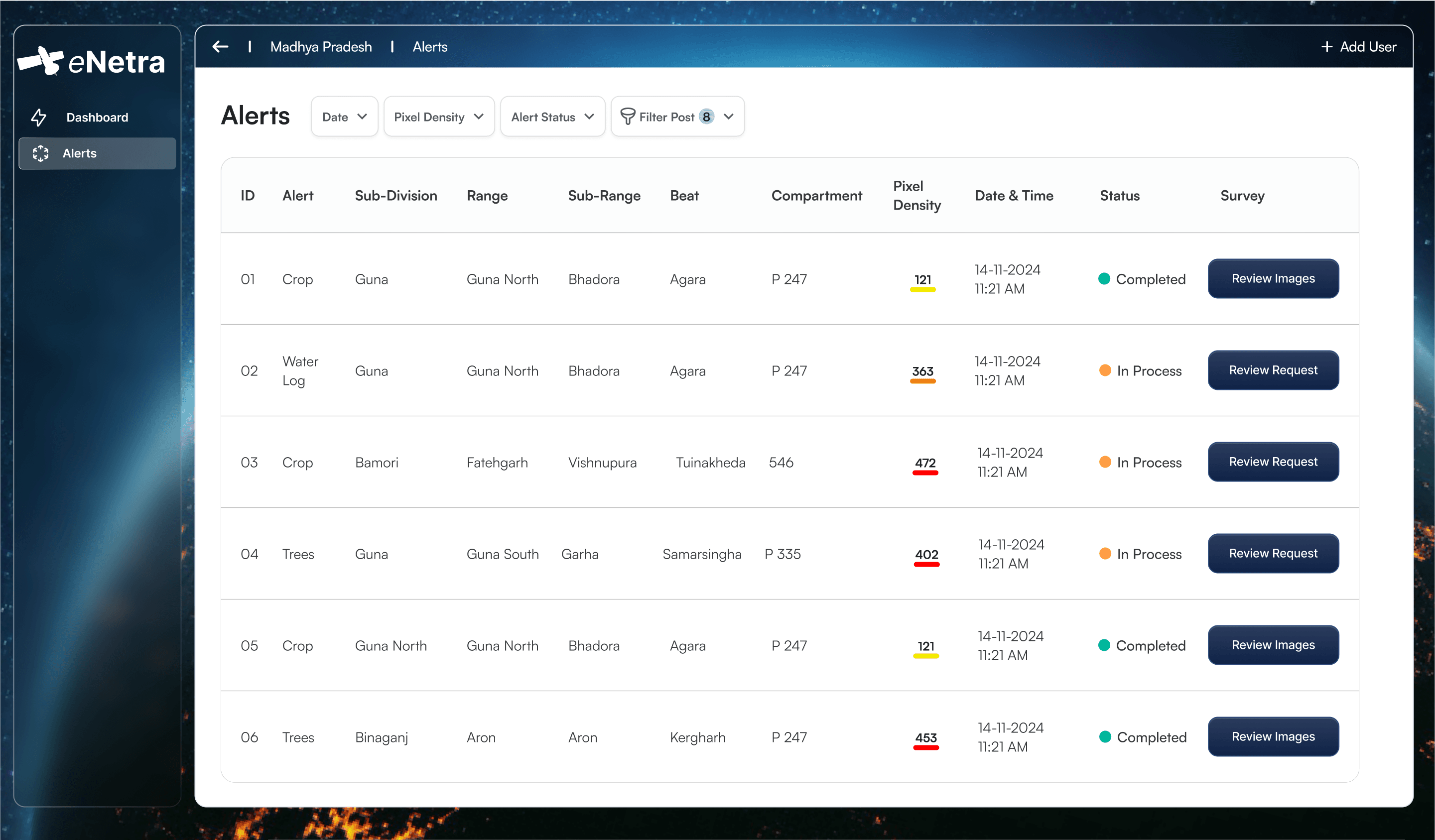
Divisional officers see new and total alerts, completed surveys and pending reviews on one screen — with filters by type, age and range — and can reassign, escalate or close without leaving the map.
One screenReportable performance metrics
Response time, closure rate and survey coverage are tracked per officer and per range, and roll up into the periodic reports that divisions already have to file.
Per officerRetained audit trail
Detection date, imagery source, officer, position, evidence and every status change are retained against the alert. A closed case is supported by the retained record rather than by recall.
Audit trailHow it works
From acquisition to closure.
Acquire
Sentinel-2 scenes over the division are pulled on a fixed cycle and masked for cloud and shadow.
Detect
Three dates are compared on Earth Engine; spectral and index change is classified into land-cover transitions.
Route
Change polygons are resolved against beat and range boundaries, scored, and pushed to the responsible officer.
Verify
The officer navigates to the site and submits geo-tagged photos, a voice note and remarks from the field app.
Close
The division reviews the evidence and closes, escalates or reopens — every step retained against the alert.
System components
The components of a deployment.
Detection engine
Scheduled change detection over the division's boundary, on managed Earth Engine compute.
- Sentinel-2 optical, three-date comparison
- Cloud and shadow masking before differencing
- Change class separated: vegetation loss, cropping, wasteland, construction
- Alert polygons with area, centroid and confidence
Divisional admin dashboard
A command centre for regional forest officers — manage alerts, coordinate teams, watch the division in real time.
- Live counts: new alerts, total alerts, surveys done, reviews pending
- Map and list views over the division, range and beat hierarchy
- Assign, reassign and escalate to named field staff
- Review submitted evidence and close or reopen a case
Field officer mobile app
A mobile client for field staff to receive, verify and close alerts.
- Push notification with precise GPS coordinates
- Turn-by-turn navigation to the alert location
- Up to four geo-tagged images plus a voice note
- Free-text remarks and a structured outcome
State-level oversight
Roll-up across divisions for headquarters, with the same evidence trail underneath.
- Division comparison on alert volume and closure
- Hotspot ranking by repeat change
- Exportable periodic reports
- Role-based access down to the beat
What you get
What a deployment delivers.
- Alert polygons with area, class and confidence
- Geo-tagged field evidence (images, audio, remarks)
- Per-officer and per-range performance reports
- Division-level change summaries by period
- Full audit trail per alert
Intended users
| Imagery | Sentinel-1 & 2, Cartosat-2 & 3, Resourcesat LISS-4, Planet Labs — and more, to suit the requirement |
|---|---|
| Detection cycle | Configurable — typically fortnightly |
| Jurisdiction model | Customisable. State, circle, division, range, beat by default |
| Field client | Android and iOS. Works offline — photographs and responses captured in remote areas sync once the officer is back on a network |
| Evidence | Up to 4 geo-tagged images + voice note per survey |
| Deployment | Managed cloud or department infrastructure |
Planned development
Under development.
Sentinel-2 for continuous forest and vegetation health monitoring
Sentinel-1 SAR for validation and cloud-free confirmation
Daily optical constellations (MODIS, VIIRS, PlanetScope) for rapid detection of large-scale events
Drone auto-pilot system for surveillance and ground validation
Request a demonstration over your area of interest.
Provide the boundary of your jurisdiction and we will run Forest Monitoring against current imagery of that area.
Other systems