
Method
Accountability in detection workflows
Most monitoring systems terminate at detection. The interval between a change polygon and a closed case is where the operational value lies, and it is primarily an organisational problem rather than a remote-sensing one.
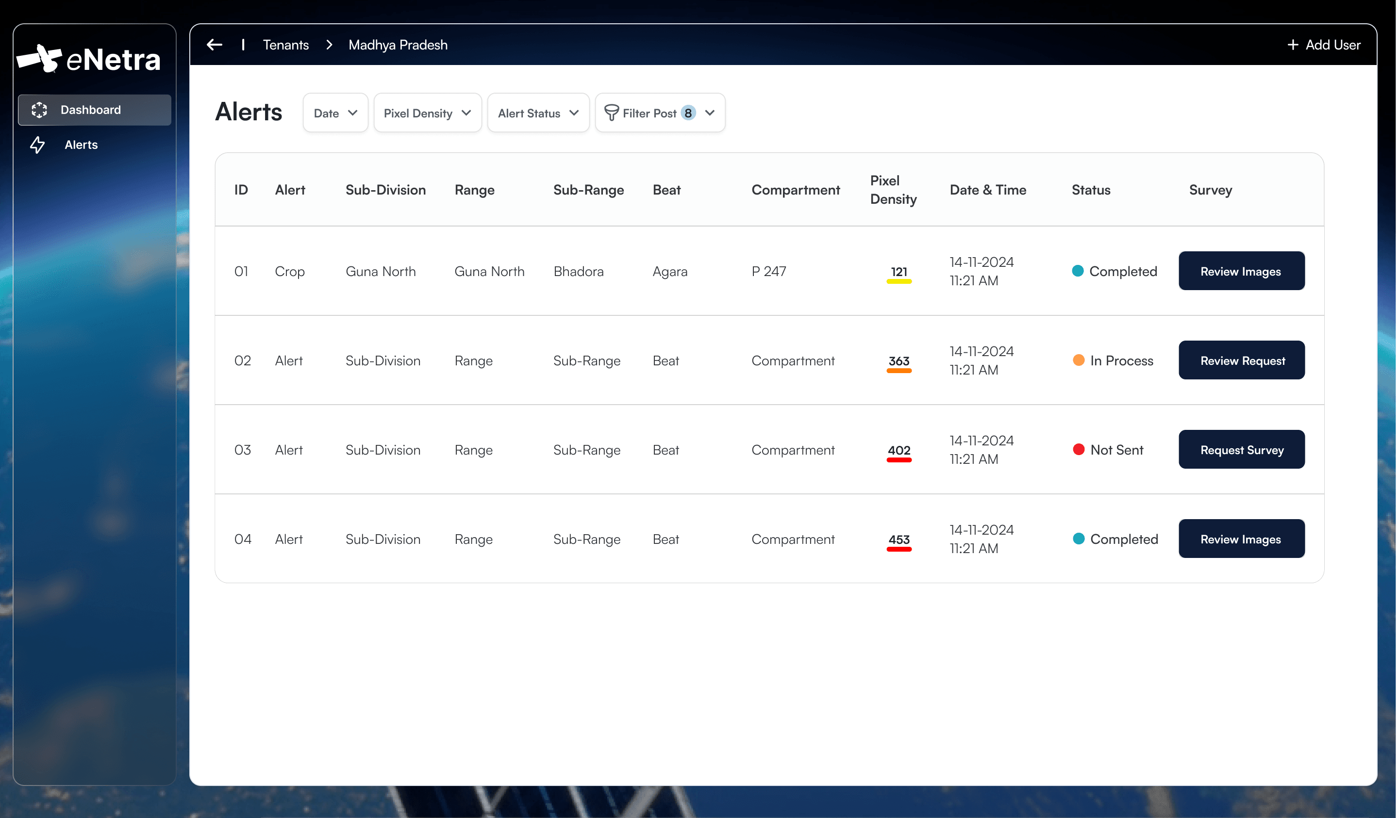
Change detection has stopped being the hard part. Open optical data at ten-metre resolution arrives every few days. Sub-metre commercial imagery is a procurement decision rather than a research programme. If your problem is can this change be seen, that problem is solved and has been for a while.
The problem that is not solved is what happens next.
The gap
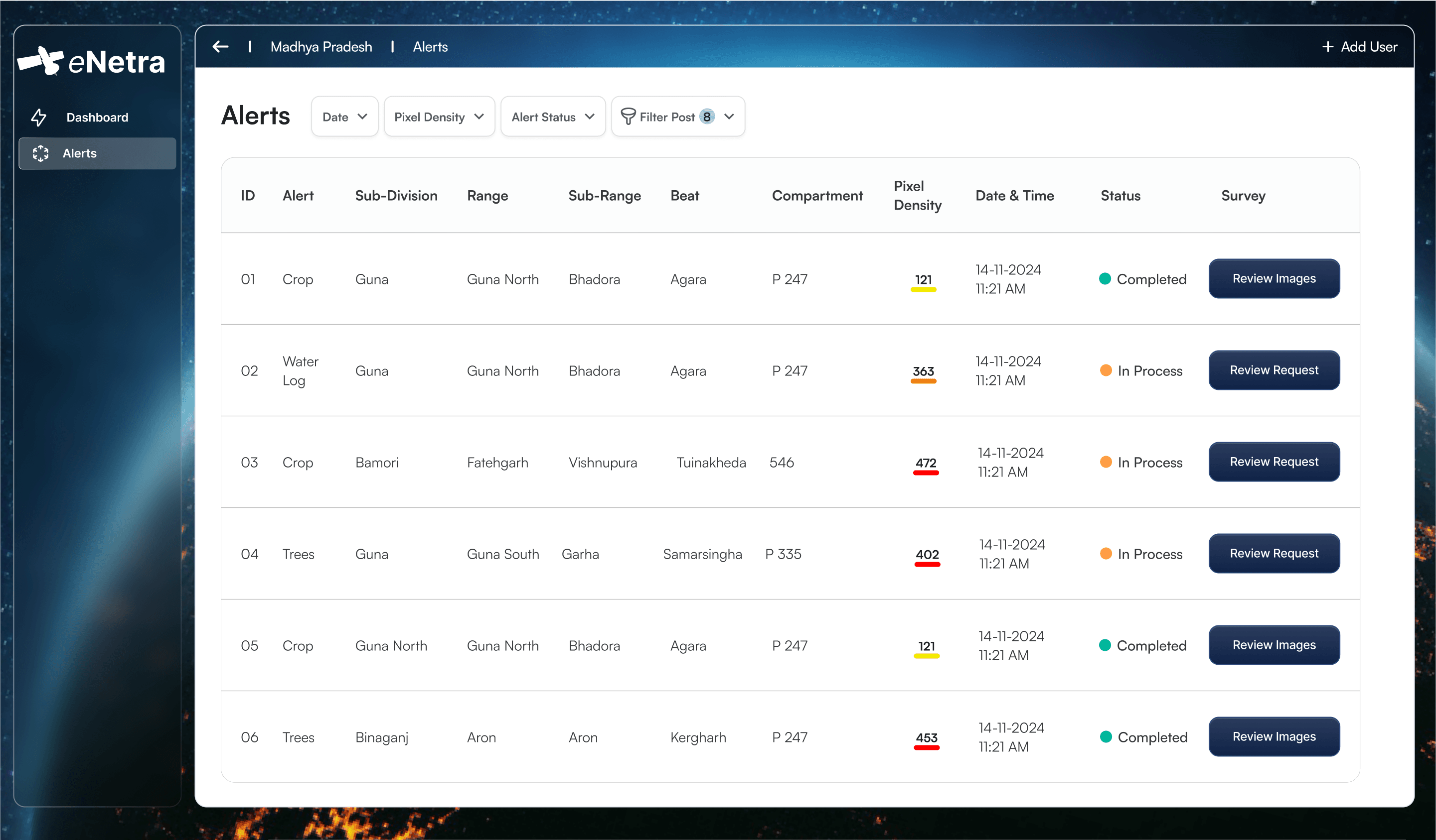
A detection is a polygon with a date. To become useful it has to acquire four things it does not have: a person responsible for it, a visit, a finding, and an ending. Systems that produce detections and stop have handed the organisation a longer to-do list and called it intelligence.
The symptom is familiar to anyone who has run one. Alert volume rises. Response does not. After a few months the dashboard remains open on a second monitor and is no longer consulted, because looking at it does not produce an outcome.
Routing is the whole trick
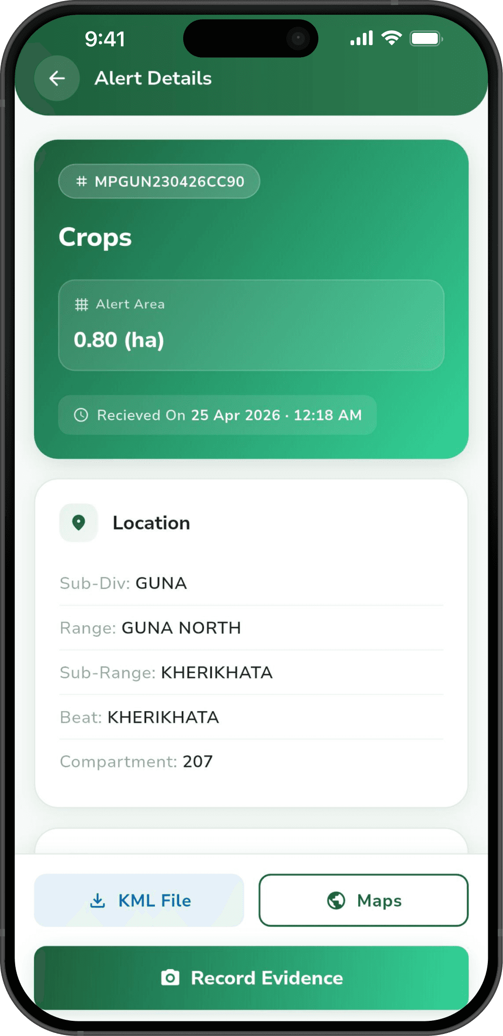
An alert sent to a shared inbox belongs to nobody. An alert routed by jurisdiction — to the beat, the range, the division, the section whose boundary contains it — belongs to a named person, and named people close things.
This sounds administrative because it is. It is also the single design decision that determines whether a monitoring programme survives its first year. Every organisation that is accountable for ground already has a boundary map and a person per boundary. Detections should arrive inside that structure rather than beside it.
Evidence, not a tick box
The second failure is a closure workflow that accepts a single tap. If "resolved" costs nothing to record, the field data is worthless within a quarter — not because anyone is dishonest, but because a tick box under time pressure collects taps rather than findings.
What closes a case should be evidence: geo-tagged photographs, structured remarks, position and time stamped by the device rather than typed. Then a closure is reconstructable, which means it is defensible, which means it is worth collecting.
- Open — detected, routed, waiting for a visit.
- Verified — someone went, and the evidence says what they found.
- Closed — closed by review of that evidence, not by ageing out.
Why nothing ages out
Auto-closing stale alerts is the most tempting feature in this category and the most corrosive. It makes the numbers look good and destroys the only thing the record was for. A backlog that is visible is a resourcing conversation. A backlog that closes itself is a fiction.
Detection is a component of the system rather than the system itself. The output is a closed case with its supporting evidence retained.
More reading
All notes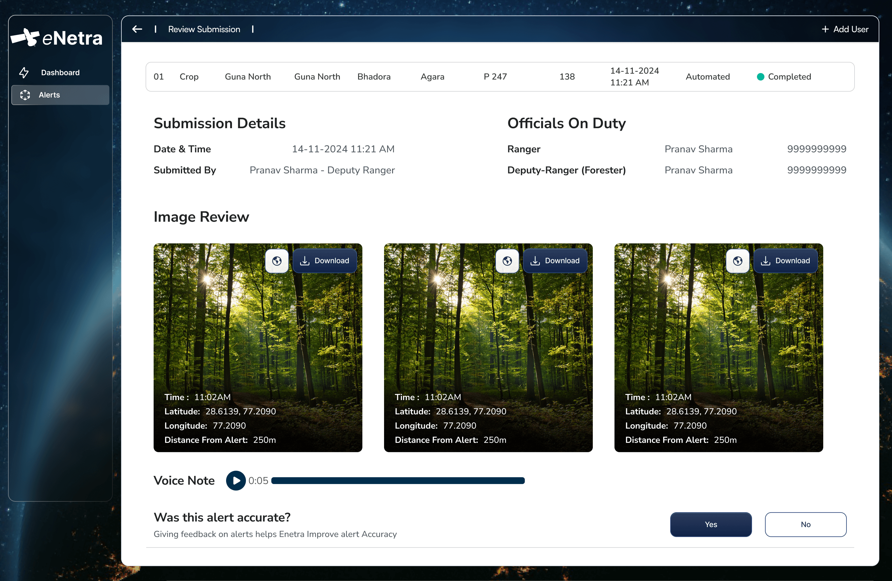 TransmissionDeriving tree height from shadow geometryA satellite observes a tree from above and cannot measure it vertically. Height must therefore be derived, and shadow geometry is a measurement of the individual tree rather than an inference from a growth equation.8 min
 ForestOptical and SAR imagery under monsoon conditionsOptical imagery is more tractable and more legible. For four months of the year across much of India it also records cloud. Sensor selection is determined by when the answer is required.7 min
 MethodDomain-specific detection modelsA crown detector for a transmission corridor and a land-cover classifier for a forest division are different models with different failure modes. Applying one across both is a common cause of undetected degradation.7 min